Wednesday 29 October 2014

Shillong - Meghalaya

Shillong

Shillong is the capital and hill station of Meghalaya. It is the headquarters of the East Khasi Hills district, situated at an average altitude of 4,908 feet above sea level. It is said that the rolling hills around the town remind the European settlers of Scotland, hence it is known as the "Scotland of the East".

River:


  • Brahmaputra - Also known as Tsangpo-Brahmaputra, it’s a trans-boundary river – one of the biggest in Asia. The river island formed by the Brahmaputra is called Majuli. It is situated in Assam. India. The river has its origin from the Angsi Glacier which is located in the northern side of the Himalayas, in Burang County of Tibet as the Yarlung Tsangpo River. It flows across southern Tibet, breaking through the Himalayas in great gorges and into Arunachal Pradesh, where it is known as Dihang or Siang.It flows south-west through Assam Valley as Brahmaputra and south through Bangladesh as Jamuna (not to be mistaken as India’s Yamuna). In the vast Ganges Delta it merges with Padma, the main distributary of the Ganges, then the Meghna before emptying into the Bay of Bengal. 

Lakes:


  • Umiam Lake - It is a reservoir located in the hills 15 km to the North of Shillong. It was created by damming the Umiam river in the early 1960s. The principal catchment area of the lake and dam is spread over 220 square km.
  • Wards Lake - It is locally known as Nan-Polok. Wards Lake is an artificial lake with garden and boating facilities.


Hill Range:


The view from the peak
  • Shillong Peak – It is a picnic spot about 10 km away from the city. The peak is 1965m above sea level and offers a panoramic view of the scenic countryside. It is the highest point in the state. Respect is paid to U Shulong at the sanctum sanctorum at the peak's summit every spring time by the religious priest of Mylliem State.


  • Elephant Falls- It’s about 12 km outside the city. The mountain stream descends through two successive falls set in dells of fern covered rocks.

Delhi

Delhi

Also known as the National Capital Territory of India is the capital city of India. It is the largest urban agglomeration in India, by land area and population. Delhi has been continuously inhabited since the 6th century BC. Through most of its history, Delhi has served as a capital of various kingdoms and empires. It has been captured, ransacked and rebuilt several times, particularly during the medieval period, and modern Delhi is a cluster of a number of cities spread across the metropolitan region.

Hill Range:


Aravalli Range
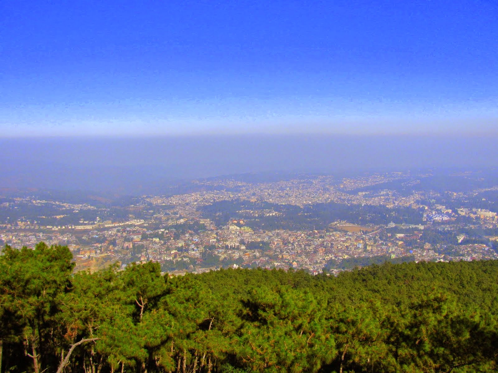
  • Aravalli Range - It literally means 'line of peaks'. Its a range of mountains in western India running approximately 800 km in a northeastern direction across Indian states of Gujarat, Rajasthan, Haryana and Delhi. It is also called Mewat hills locally.


Asola-Bhatti Wildlife Sactuary
  • Asola-Bhatti Wildlife Sanctuary – It lies at the far southern edge of the city of Delhi, at Asola near Tughlaqabad in the Delhi, the National Capital Territory of India. This protected area contains one of the last surviving remnants of Delhi Ridge hill range, its semi arid forest habitat and its dependent wildlife, the northernmost extension of the Aravalli mountains that begin in the state of Rajasthan. Once this forested ridge area extended throughout the city of Delhi, but development has all but destroyed it. The reserve is found at the end of a rutted track that leads through a dusty unlicensed village

River:


Yamuna – Sometimes referred
Triveni Sangam, Allahabad
(notice the difference in the colours
of the two rivers)
to as Jamuna, It’s the largest tributary of the Ganges in the north. The river originates from the Yamunotri Glacier at a height of 6,387m on the south-western slopes of the Banderpooch peaks in the uppermost region of the Lower Himalayas in Uttarakhand. Yamuna travels a total length of 1,376 km (855 mi) and has a drainage system of 366,223 square km (141,399 sq mi), 40.2% of the entire Ganges Basin, before merging with the Ganges at
Triveni Sangam, Allahabad.

Lakes:


Bhalswa Horseshoe Lake – Also known as Bhalswa Jheel, the lake is situated in northwest Delhi, India. It was originally shaped like a horseshoe however over the years half of the horseshoe was used as a landfill area, and now a low income housing colony. An extension of the nearby town of Bhalswa Jahangirpur has been built on it, destroying the once excellent wetland ecosystem and wildlife habitat of the region which once played host to scores of local and migratory wildlife species, especially water birds including waterfowl, storks and cranes.


Sanjay Lake - This is an artificial lake developed by Delhi Development Authority (DDA) in Trilokpuri in East Delhi., adjoining Mayur Vihar II residential area. Spread over 170 acres it was developed in the 1970s. The lake also attracts some migratory birds and has many indigenous trees. A well-laid-out fitness track is very popular with walking enthusiasts.

Najafgarh Lake - Najafgarh Marsh or Najafgarh Jheel used to be a vast lake in the south west of Delhi near the town of Najafgarh from which it takes its name. It was connected to the river Yamuna by a natural shallow null
ah or drain called the Najafgarh nullah. However after the 1960s the Flood Control Department of Delhi kept widening the Najafgarh drain in the pretext of saving Delhi from floods and eventually quickly drained the once huge and ecologically rich Najafgarh lake completely. Rainwater accumulating in the Najafgarh lake or jheel basin had bee
n recorded to have occ
upied more than 300 square kilometres (120 sq mi) in many years before its unfortunate draining.

Keetham lake – It’s a scenic lake just outside Agra on the Agra - Delhi highway (NH 2). The Keetham lake is also known as the Sur Sarovar. It is a tranquil spot, ideal for a relaxed outing. A wide variety of fish and water-birds add to the lake's natural charm and beauty. This scenic lake, is about 20 KM from Agra and 12 km from Sikandra. It is located within the Sur Sarovar Bird Sanctuary. Keetham Lake is linked by Railway track at Keetham Railway Station and was declared as National Bird Sanctuary in 27 March 1991 by U.P. Forest Department. The riverine belt of River Yamuna surrounds the area of Sur-Sarovar

Badkhal Lake – This was a natural lake situated in Faridabad, Haryana, about 32 kilometers from Delhi. It was a natural lake surrounded by hilly areas of the Aravali Range in Haryana. The lake is a almost completely dried up grassy terrain with unusually low rainfall. Certain mines surrounding the lake are also responsible for blockage of flow of water to the lake's reservoir. Some mineral water companies are responsible as well, for taking water from the lake for their purposes.

Mangalore - Karnataka

Mangalore

Mangalore is the chief port city of Karnataka. It lies between the Arabian Sea and the Western Ghats.With its pristine beaches, broad roads and calm localities this coastal city was declared the eighth cleanest city in India.The city's landscape is characterised by rolling hills, coconut palms, freshwater streams, and hard red-clay tiled-roof buildings.

Hill Range:


Light Hour Hill Garden
  • Light House Hill - It is situated in Hampankatta, the heart of Mangalore City in South India. Light House Hill is the location of two famous educational institutions in Mangalore, namely St. Aloysius College and Kasturba Medical College.
  • Padav hills - These are a range of hills in the Mangalore taluk, Karnataka. During the mid-nineteenth century, Bishop Victor Fernandes, a Mangalorean Catholic priest, erected a large cross at former outskirts of Mangalore in Nanthoor near Padav hills to honour the memory of Mangalorean Catholic martyrs who died on the march and during their fifteen-year captivity at Seringapatam.

  • Nagara hill - It is a historic place in the Shimoga district of the state of Karnataka. It is 17 km from Hosanagara or 84 km from Shimoga. This was called "Bidanur (Bidanoor)" earlier during the 16th century, and was the last capital city of Keladi rulers. Nagara was resided by an independence activist by the name of Sripathy Rao Baliga (1914-2003) who continued to work for the welfare of the village in the post independence era.

Rivers:

Netravati River Dharmasthala 
  • Netravati River - It has its origins at Bangrabalige valley, Yelaneeru Ghat in Kudremukh in the Chikkamagaluru district of Karnataka, India. This river flows through the famous pilgrimage place Dharmasthala and is considered as one of the Holy rivers of India. It merges with the Kumaradhara River at Uppinangadi before flowing to the Arabian Sea, south of Mangalore city. This river is the main source of water to Bantwal and Mangalore. The Netravati railway bridge is one of the known bridges which serve as the gateway to Mangalore.

  • Gurupura River - Also known as Phalguni River or Kulur Rive, it originates in the Western Ghats and empties into the Arabian Sea at Mangalore. It gets its name from the town Gurupura situated near Mangalore. The New Mangalore Port and Mangalore Chemicals and Fertilizers are situated on its northern banks. Once upon a time it formed northern boundary of Mangalore city along with Netravati River as southern boundary.


Pilgrims taking a dip at the river
      
  •  Kumaradhara River - It is one of the two major rivers of Sullia, and merges with the Netravati River at Uppinangadi before flowing to the Arabian Sea. The merging of the rivers is a major event for the local villagers, as they crowd the river banks to watch what they call the "Sangam", which is a Sanskrit word for confluence. Pilgrims going to the Kukke Subrahmanya Temple in Subrahmanya have to cross the Kumaradhara River, taking a holy bath in it before they go on to the temple to have darshan, a glance from a holy person.

Birds:

  • Grey francolin,
  • Common quail
  • Rain quail
  • Jungle bush quail,
  • Painted bush quail,
  • Red spurfowl,
  • Painted spurfowl,
  • Grey junglefowl,
  • Indian peafowl,

Mysuru - Karnataka

Mysuru

Formerly known as Mysore, it is the third largest city in Karnataka and served as the capital city of the Mysore Princely Kingdom (aka Kingdom of Mysore) for nearly 6 centuries. The kingdom of Mysore was ruled by the Wodeyar Dynasty, except for a brief period in 18th century when Hyder Ali and Tipu Sultan were in power. It is known as the Culture Capital of Karnataka.Mysore is noted for its palaces, including the Mysore Palace, and for the festivities that take place during the Dasara festival when the city receives a large number of tourists. It lends its name to the Mysore style of painting, the sweet dish Mysore Pak, the Mysore Peta (a traditional silk turban) and the garment known as the Mysore silk saree.

Hill Range:


Chamundeshwari Temple
  • Chamundi Hills – These hills are located close to the palace city of Mysore, about 13km east of the city. Their average elevation is 1,000 metres (3,300 ft). Patronized for centuries by the rulers of Mysore, the Chamundeshwari Temple is located atop the Chamundi Hills and was renovated during the time of Krishnaraja Wodeyar III (1827).


Vindhyagiri Hill
  • Vindhyagiri – It is one of the two hills in Shravanabelagol in Karnataka. The Large Hill was first referred to as "Per kavappu" in 8th Century, but its history begins with that of Gommateshwara in the Late 10th century. A century and half later the town was named Gommatapura, after the colossus, but the hill itself is not identified with a distinctive name. The present name "Vindhyagiri" is said to be derived from vim, spirit and dhya, meditation, as being the spot consecrated by saints observed in the meditation on the supreme spirit.


  • Chandragiri - is the other of the two hills in Shravanabelagola in Karnataka. The recorded history surrounding the hill started in 300 BC when Shruthakevali, Bhadrabahu and Chandragupta Maurya visited the place in order to attain religious peace. The Small Hill derives its name of Chandra from the fact that Chandragupta was the first of the saints who lived and performed penance there.


River:


Kaveri river basin
  • Kaveri - Also written Cauvery in English, is a large Indian river. The origin of the river is traditionally placed at Talakaveri, Kodagu in the Western Ghats in Karnataka. It flows generally south and east through Karnataka and Tamil Nadu and across the southern Deccan plateau through the southeastern lowlands, emptying into the Bay of Bengal through two principal mouths.


Birds:


  • Grebes
  • Shearwaters and petrels
  • Storm petrels
  • Tropicbirds
  • Pelicans
  • Boobies and gannets
  • Cormorants 
  • Darters
  • Frigatebirds
  • Bitterns, herons and egrets 
  • Storks 
  • Ibises and spoonbills 
  • Flamingos
  • Ducks, geese and swans 
  • Osprey
  • Hawks, kites and eagles 
  • Falcons 
  • Pheasants and partridges 
  • Buttonquails
  • Cranes
  • Rails, crakes, gallinules and coots 
  • Bustards 
  • Jacanas
  • Painted snipe
  • Oystercatchers
  • Avocets and stilts 
  • Thick-knees
  • Pratincoles and coursers 
  • Plovers and lapwings 
  • Sandpipers and allies 
  • Skuas
  • Gulls

Tuesday 28 October 2014

Nellore - Andhra Pradesh

Nellore

Nellore is a city and municipal corporation in the South Indian state of Andhra Pradesh.It is the administrative headquarters of Sri Potti Sri Ramulu Nellore district. The ancient name of Nellore was "Vikrama Simhapuri". It is located on the banks of the Penner River and is well known for its agricultural and aquaculture produce.


Rivers:


  • Maldevi – It is a river which runs through the Nellore district. It empties into the Pennar river. The Vijayanagara empire built the Anantraj Sagar water storage tank using a 1.37km long dam on this river.

  • Penner - Also known as Pennar or Penna, it rises on the hill of Nandi Hills in Chikballapur District of Karnataka state and runs north and east through the state of Andhra Pradesh to empty into the Bay of Bengal. It is 597 kilometres (371 mi) long, with a drainage basin 55,213 square kilometres (21,318 sq mi) large.
Penner River

Lake:

Flamingos at Pulicat Lake
  • Pulicat Lake - It is the second largest brackish–water lake or lagoon in India, after Chilika Lake. It straddles the border of Andhra Pradesh and Tamil Nadu states on the Coromandal Coast in South India. The lake encompasses the Pulicat Lake Bird Sanctuary. The barrier-island of Sriharikota separates the lake from the Bay of Bengal. The island is home to the Satish Dhawan Space Centre.


Hill Range:

       
  • Venkatagiri – It is a  town, municipality and mandal headquarters in the Nellore district. Venkatagiri's old name is "Kali Mili". It is famous for its Handloom Cotton Sarees. Venkatagiri is a place for history and handlooms. It was part of a small kingdom that was integrated into the Indian Republic.Venkatagiri is well connected by Road and Rail Transport. Famous pilgrimage places like Kalahasti, Kanipakam and Tirupati are within a short distance and can be easily reached by Railways and Roadways. It is also notably close to Chennai, a major port city of India.
  • Udayagiri Hills - The Udayagiri Hills is the main tourist attraction here and is mingled with history. The hill is mentioned in the Ramayana, where Hanuman, the monkey god carried the hill to Lanka for a rare herb called as Sanjeevini, which is found on this hill, to cure Lakshman. After serving its purpose, the hill was supposedly thrown by Hanuman from a great height into the same place. The hill landed upside down, and till this day one can find many boulders strewn around the hill. Also it is believed that some trees grow upside down too! The hill has crystal clear water flowing downhill from an unknown source, which till date has not been found. The water from the hill is used for drinking by all the people of Udayagiri. Temples for Udaya Lakshmidevi, Udaya Lakshmi Narasimha Swamy Devastanam, Duragampalli village loddi, Kona, Tapka, Choti Masjid & Badi Masjid are the main places to visit on the hill.

       
  • Narasimha Konda – It is a hill near the town of Jonnawada in Nellore district of Andhra Pradesh state in India. It is a Hindu pilgrimage center and the site of an ancient temple dedicated to the God Narasimha. It is a small hill place 18 km away from Nellore and 5 km away from Jonnawada. As per history it is said that there are 7 devotional gundam (ponds) there and the place was very powerful and there was a mark made by the Lord on the hill, which is still clearly visible.

Birds:

  • Spot-billed Pelican,
  • seven species of herons and egrets,
  • Painted Stork,
  • Greater Flamingos,
  • ducks,
  • shorebirds,
  • gulls,
  • terns,
  • Little Grebe,
  • Indian Cormorant,
  • Little Cormorant,
  • Asian Openbill Stork,
  • Black-headed Ibis,
  • Eurasian Spoonbill,
  • Lesser Whistling Teal,
  • Spotbill Duck,
  • Great Thick-knee 
  • Stone Curlew.
  • Bar-headed Goose,
  • Ruddy Shelduck,
  • Eurasian Wigeon,
  • Gadwall,
  • Common Teal,
  • Northern Pintail,
  • Garganey,
  • Northern Shoveler,
  • Common Pochard,
  • Brown-headed Gull,
  • Black-headed Gull,
  • Whiskered Tern,G
  • ull-billed Tern
  • Caspian Tern.

Vijayawada - Andhra Pradesh

Vijaywada

Vijaywada is the second largest city and forms part of the capital area of the state of Andhra Pradesh. It is located in the banks of the Krishna River. It is the "Business Capital of Andhra Pradesh".The political, agricultural, industrial sectors are a boon for its recognition. It is the hub of transportation with one of the largest railway junctions in India.


Hill Range:


Narsimha temple
  • Vedadri hill - Among the several shrines of Lord Laxmi Narasimha Swamy that flourished on the holy banks of the river KrishnaVedadri is an important one. It is situated only 10 km from Chillakallu on the National Highway No.9 from Vijayawada to Hyderabad.

Gandhi Memorial
  • Gandhi Hill - It is a popular hill and a tourist attraction, situated at an elevation of 500 ft (150 m) above the main town of Vijayawada. It is located right behind the Vijayawada railway station in Tarapet area of the city. Gandhi Memorial, built on this hillrock is the first of its kind in the country with seven stupas and hence the hill is also popularly known by the name of Gandhi.

River:

      
  • Krishna River - It is the third longest river in central−southern India, after the Ganges and the Godavari. The river is almost 1,300 kilometres (810 mi) long. It is also known as Krishnaveni . It is a major source of irrigation for KarnatakaMaharashtraTelangana, and Andhra Pradesh.The river originates at Mahabaleswar near the Jor village in the extreme north of Wai Taluka, Satara District, Maharashtra in the west and pours into the Bay of Bengal at Hamasaladeevi (near Vijayawada) in Andhra Pradesh, on the east coast. It flows through the state of Karnataka before entering Telangana and thereafter Andhra Pradesh.

  • Budameru - It a river in Krishna district which originates in the hills surrounding Mylavaram and empties itself into Kolleru Lake. Budameru is also known as The Sorrow of Vijayawada. In order to control the floods, the river was dammed at Velagaleru village and a diversion channel named, Budameru Diversion Channel (BDC) was constructed from Velagaleru to join Krishna River upstream of Prakasam Barrage.

Lakes:

       
  • Kolleru Lake- is one of the largest freshwater lakes in India located near Vijayawada in the state of Andhra Pradesh . Kolleru is located between Krishna and Godavari delta. Kolleru spans into two districts - Krishna and West Godavari. The lake serves as a natural flood-balancing reservoir for these two rivers. The lake is fed directly by water from the seasonal Budameru and Tammileru streams, and is connected to the Krishna and Godavari systems by over 68 in-flowing drains and channels.this lake is a major tourist attraction. 


Birds:

The following birds migrate to Kolleru lake at Vijayawada in winter:

  • Siberian crane
  • Ibis, 
  • Painted storks. 
  • Grey billed Pelican 
  • Spot-billed Pelican 

Nagercoil and Kanyakumari - Tamil Nadu

Nagercoil

Nagercoil is a town in the southernmost Indian state of Tamil Nadu and a municipality and administrative headquarters of Kanyakumari District. The town is situated close to the tip of the Indian peninsula, locked with the Western Ghats on all sides.

Kanyakumari

Kanyakumari formerly known as Cape Comorin, is a town in Kanyakumari District in the state of Tamil Nadu. It lies at the southernmost tip of the Indian subcontinent. Cape Comorin is the southern tip of the Cardamom Hills, an extension of the Western Ghats range along the west coast of India. The nearest major city is Nagercoil, 22 km away. Kanyakumari was one of the important towns of the ancient Tamilakam and is a popular tourist destination.

Hill Range:

       
  • Ullaakarvi falls - It is about 35 km from Kanyakumari town and about 17 km from Nagercoil town, near Azhakiyapandiapuram village. The falls is up in the middle of forested Western Ghat hills, which is accessible only on foot from the base of the hills. The hour's trek from the base of the hills is through rocky, forested area, which is thrilling in itself. On a clear day, one can view the waterfalls from the base of the hills through naked eye, or even better through binoculars/zoom lens. There are two falls - the lower falls, which is a good picnic spot, and the higher falls, which is further uphill. The water is basically spring water, coming in as a stream up from the hills nearby.

  • Marunthuvazh Malai -  Also known as the Maruthuva Malai, nearer to Vaikunda Pathi, forms the part and the southernmost tip of the Western GhatsAccording to tradition, the Maruthuva Malai is a fragment of the Sanjeevi Mountain, a piece of which fell down here, and it was carried by Hanuman from Mahendragiri to Lanka for healing the fatal wounds of Lakshmana, the brother of Rama, the epic hero. It stretches for more than a km, reaching a height of 800 feet at the highest point. It is about 2 km from Swamithoppe and 11 km from Nagercoil.

       
  • Agasthyamalai Hills - Also called the Ashambu Hills, they lie at the extreme southern end of the Western Ghats mountain range along the western side of South India. There are at least 26 peaks over 1,600 metres among these hills. The hills are notable as the habitat for over 2,000 species of medicinal plants and as the abode of the Vedic sage Agasthya, founder of the Siddhar practitioners of Rasayana herbal medicine. He is often depicted holding a mortar and pestle. These hills contain areas of exceptional natural beauty and aesthetic importance. The hills contain outstanding examples of ecosystems and communities of plants and animals representing significant ecological and biological processes.

  • Mahendragiri - Its the name of a hill in Tirunelveli District, South Tamil Nadu. It is part of the southern tip of the Western Ghats, with an elevation of 1,645.2 metres. ISRO Propulsion Complex, a test facility for Indian Space Research Organisation's launch vehicle and satellite propulsion systems, is situated on the lower slopes of this mountain.

Ayya Vaikundar procession
  • Vaikunda Malai - Its a hill which is part of the Mahendragiri Hills situated near Athala vilai of Kanyakumari district in the Western Ghats of India. This hill has religious importance in the Ayyavazhi religion during the festival of Ayya Vaikunda Avataram, the day of incarnation of Ayya VaikundarDuring the celebration two processions, one from Thiruvananthapuram and other from Tiruchendur, reach Athala vilai and circle the hill. A flame is lit at the top of this hill to symbolise the birth of VaikundarUnlike other Ayyavazhi holy places, Vaikunda Malai is not mentioned in the Ayyavazhi scriptures.

  • Anaimalai Hills - Its a range of mountains in the Western Ghats in Tamil Nadu and Kerala states of South India. The name "Anaimalai" derives from the Tamil/Malayalam word 'Anai' meaning elephant and 'Malai' meaning hill, thus Elephant Hill. The highest peak of the Anaimalai Hills is Anamudi, (2,695 meters), located in the Idukki district of Kerala. It is the highest peak in the Western ghats and South India. To the north, Palghat Gap divides the Western Ghats. The lower slopes of hills now have coffee and tea plantations as well as teak forests of great economic value.

Rivers:

Kothai River
  • Kothai- Its a river in the Kanyakumari district of Tamil Nadu state, which originates from the Kodayar Lake. Kothai is name of a female in Tamil. In Tamil it means 'Beautiful girl of no mistakes'
View from the Mathur bridge
  • Pahrali River- It flows through the Kanyakumari District in southern India. It originates in the Mahendragiri hills. The Mathur Hanging Trough, the highest and longest aqueduct in Asia, was built over it near Mathur. Perunchani dam is constructed across Pahrali river.

Lakes:

  • Parakkai Lake- is a lake in Kanniyakumari district in the state of Tamil NaduIndia. It is located near the southern tip of India, just to the north of Parakkai village and west of the town of Suchindram.

  • Kodayar Lake.

Animals:

  • Bonnet Macaque 
  • Black Napped 
  • Common Langur 
  • Elephant 
  • Gaur Bos gaurus Vulnerable 
  • Jungle Cat 
  • Leopard
  • Lion Tailed Macaque 
  • Indian Giant Squirrel 
  • Brown Mongoose 
  • Mouse Deer 
  • Nilgiri Langur 
  • Nilgiri Marten 
  • Nilgiri Tahr 
  • Palm civet 
  • Pangolin 
  • Porcupine 
  • Sambar 
  • Sloth Bear 
  • Small Indian Civet 
  • Spiny Dormouse 
  • Tiger
  • Wild boar 
  • Wild Dog
  • Indian Fox 
  • Jackal 
  • Striped Hyena 

Birds:

  • White-cheeked Barbet 
  • Yellow-browed Bulbul 
  • Red-whiskered Bulbul 
  • Black Bulbul 
  • Southern Hill-Myna 
  • Indian Hanging-Parrot 
  • Blyth's Reed-Warbler 
  • Asian Fairy-Bluebird 
  • Grey Junglefowl 
  • Plain Flowerpecker 
  • Scarlet Minivet 
  • Common Iora 
  • Red-vented Bulbul 
  • Small Minivet 
  • Common Rosefinch 
  • Indian Scimitar-Babbler 
  • Tickell’s Flowerpecker 
  • Greater Racket-tailed Drongo 
  • White-bellied Treepie 
  • Large-billed Leaf-Warbler 
  • Asian Palm-Swift 
  • Greenish Leaf-Warbler 
  • Small Sunbird 
  • Grey-headed Bulbul 

Tirunelveli's Environment

Tirunelvelli

Tirunelveli also known as Nellai and historically as Tinnevelly, is a city in Tamil Nadu. Its is believed to be an ancient settlement; it has been ruled at different times by the Early Pandyas, the Medieval and Later Cholas, the later Pandyas, the Ma'bar and Tirunelveli sultanates, the Vijayanagar Empire, the Madurai NayaksChanda Sahib, the Carnatic kingdom and the British. Tirunelveli has a number of historical monuments, the Nellaiappar Temple being the most prominent.


Hill Range:


  • Mahendragiri - It is the name of a hill in Tirunelveli District and is a part of the southern tip of the Western Ghats, with an elevation of 1,645.2 metres. ISRO Propulsion Complex, a test facility for Indian Space Research Organisation's launch vehicle and satellite propulsion systems, is situated on the lower slopes of this mountain.


  • Courtallam - It is the panchayat town situated at a mean elevation of 160 m

on the Western Ghats in Tirunelveli District of Tamil Nadu. Many seasonal and few perennial rivers such as the Chittar River, the Manimuthar River, the Pachaiyar River and the Tambaraparani River originate in this region. The numerous waterfalls and cascades along with the ubiquitous health resorts in the area have earned it the title the Spa of South India. The falls carry a good amount of water only when there is a rain on the hills. Season begins from June of every year till September. The South West Monsoon brings in the cold breeze with mild temperature. From October to December North East Monsoon sets over in Tamil Nadu and the climate is cold and the rains are very heavy sometimes. Sometimes the falls get flooded and people are not allowed to take bath during floods.

Rivers:

     
Manimuthar Dam

  • Manimuthar River - It originates on the eastern slopes of Western Ghats in Tirunelveli District of the state of Tamil Nadu. It is a major tributary of the Tambaraparani River.The river begins in the dense forest on a mountain peak 1300 meters above sea level in Ambasamudram taluk and flows 9 km though small cataracts until it reaches the Tambaraparani River near Kallidaikurichi.The tributaries of the Manimuthar are the Keezha River and the Varattar River. As a tributary, the Manimuther River adds a considerable amount of water to the Tamiraparani River as it seasonally is always in full.


  • Nambiyar river - It runs across Nanguneri taluk in Tirunelveli district in Tamil Nadu state in India. It is a small river which runs for only 45 km. The river originates from near Thirukurungudi village in the Western Ghats, about 1.5 km above sea level, and ends at the Gulf of Mannar.


  • Thamirabarani River - It originates from the famous Agastyarkoodam peak in the hills of the Western Ghats above Papanasam in the Ambasamudram taluk and flows through Tirunelveli Tuticorin districts of the Tamil Nadu state of southern India. It was called the Tamraparni River in olden days, a name also associated with Sri Lanka. The old Tamil name of the river is Porunai. From the source to sea, the total length of the river is about 125 km.

     
  • Chittar River - The river and its five tributaries and numerous other contributing streams originate in the Courtallam hills of Tirunelveli District in the state of Tamil Nadu. Together with its tributaries and streams, the Chittar River serves as an important source of irrigation for the region and is a major tributary of the Tambaraparani River along with the Manimuthar River. The Chitter River, though little, is a beautiful river, making many turns and twists and providing spectacular waterfalls and cascades.

Other Rivers - 
  • Mundhal Odai
  • Karunaiyar
  • Mottaiyar
  • Vedamaliyaru
  • Rajasingiyaru
  • Kothaiyaru
  • Ramanathi
  • Hanumannathi
  • Gadananathi

Birds:

  • Bar-headed Goose,
  • Common Sandpiper,
  • Common Teal,
  • Coot Central,
  • Green Sandpiper,
  • Greater flamingo,
  • Pintail,
  • White stork