Tuesday, 28 October 2014

Visakhapatnam - Andhra Pradesh

Vishakhapatnam

Visakhapatnam a.k.a Vizag is the largest city in Andhra Pradesh and the third largest city on the east coast of India. It is a port city on the southeast coast of Bay of Bengal and often called as "The Jewel of the East Coast" and the "City of Destiny". It is the administrative headquarters of Visakhapatnam district and  Visakhapatnam. The city is known for heavy industries, steel plant, largest seaport of India and oldest shipyard. It has the only natural harbour of India and is the headquarters of the Eastern Naval Command of the Indian Navy.

Hill range:

      
  • Kailasagiri - It is a hilltop park in the city of Visakhapatnam. The park was developed by Visakhapatnam Urban Development Authorty (VUDA) comprising 380 acres (150 ha) of land covered with flora and tropical trees. The hill, at 360 feet (110 m), overlooks beaches, forests, and the city of Visakhapatnam.

  • Bavikonda - 
    It is an important Buddhist heritage site located on a hill about 15 km, northeast from Visakhapatnam city. Here the Buddhist habitation is noticed on a 16 ha flat terraced area. The Hinayana school of Buddhism was practised at the monastery between the 3rd century B.C. and the 3rd century A.D. Bavikonda has remains of an entire Buddhist complex, comprising 26 structures belonging to three phases. A piece of bone stored in an urn recovered here is believed to belong to the mortal remains of the Buddha.

      
  • Pavuralakonda - Also known as "pigeon hill" it is a hillock west of Bhimli, about 24 km from Visakhapatnam. The Buddhist settlement found here is estimated to date back from the first century BC to the second century AD. On the hillock (which overlooks the coastline) are 16 rock-cut cisterns for collecting rainwater. Gopalapatnam, on the Tandava River, is a village surrounded by brick stupas, viharas, pottery and other Buddhist artefacts.

Rivers:

  • Nagavali River - It rises in the eastern slopes of the Eastern Ghats near Lakhbahal in the Kalahandi district of Odisha at an elevation of about 1,300 metres. Another name of the river Nagavali is Langulya. The total length of the river is about 256 km, of which 161 km are in Odisha and the rest in Andhra Pradesh. Nagavali is an interstate river basin. The river basin receives 1000 mm average rain fall annually. The uplands of the river basin are hilly areas with predominantly tribal populated. It drains parts of the Kalahandi, Rayagada and Koraput districts of Odisha and Srikakulam, Vizianagaram districts of Andhra Pradesh. Niyamgiri hills where Bauxite mining is proposed are located in Nagavali river basin.
  • River Vamsadhara - The river originates in the border of Thuamul Rampur in the Kalahandi district and Kalyansinghpur in Rayagada district of Odisha and runs through many districts including Vizag, for a distance of about 254 kilometers, where it joins the Bay of Bengal at Kalingapatnam, Andhra Pradesh. Tourist attractions of Mukhalingam and Kalingapatnam in Srikakulam district are located on the banks of this river.

Birds:


  •  Pelicans (Rosy and Grey), 
  • Painted Storks, 
  • Peafowls,
  • Ducks,
  • Spotted Doves,
  • love birds, 
  • Parakeets, 
  • Eagles, 
  • Vultures
  • Budgerigars, 
  • Macaws, 
  • Ostrich, 
  • Emu

Friday, 24 October 2014

Puducherry (Pondicherry)

Puducherry

Previously known as Pondicherry, it is a city, an urban agglomeration and a municipality in Pondicherry district in the Indian union territory of Puducherry. It is affectionately known as Pondy.

Rivers:

      
  • Sankaraparani River - It originates on the western slope of Gingee Hill in Viluppuram District of the State of Tamil Nadu. It has two source, one in the Pakkammalai hills and one in the mountains of Melmalayanur. They join near Thenpalai village to form the main river. Sankaraparani is also known asVarahanadi or Gingee River. River Sankaraparani, flows to the east. The Annamangalam surplus joins near Melacheri. The third tributary Thondiar joins near Vidur. The Vidur reservoir across Sankaraparani is situated just below .From Vidur reservoir, Sankaraparani flows southeast. Pambaiyar tributary joins near Radhapuram. Then Sankaraparani enters Puducherry ( Pondicherry)Union Territory at Manalipet.

  • Guduvaiyar River - Sometimes pronounced Kuduvaiyar it flows through the Cuddalore and Villupuram districts of Tamil Nadu and Puducherry Union Territory. It is a stream that originates near Valavanur. It generally gets flooded during the monsoon season. Few bed dams exists in its course, one at Kizhur is the major one. This river joins Sankaraparani River near Chunnabar Bridge (NH-45A) at Ariyankuppam. It forms a border between Tamil Nadu and various enclaves of Puducherry.

  • Ponnaiyar River - It is a river in southern India. It rises on the hill of Nandidurg in Chikkaballapur District of Karnataka state, and flows south and then east for 400 km through Karnataka,Tamil Nadu, and Puducherry (Pondicherry), before emptying into the Bay of Bengal at Cuddalore. 
  • Other Rivers-
  1. Malattar River
  2. Pambaiyar River

Birds:

Pondicherry is an important area for migratory birds.The species are:

  • Phalacrocorax Niger
  • Eurasian Wigeon
  • Cotton Teal
  • Common Coot
  • Spotted Billed Pelicon
  • Darter
  • Painted Stork
  • Eurasian Spoonbill
  • White Ibis 

Wetlands:


  • Kaliveli Wakeland (or) Kaliveli Lagoon - It is a coastal lake and lagoon with wetlands in the Viluppuram District of Tamil Nadu state.This lake is on the Coromandel Coast, near the Bay of Bengal. It lies approximately 16 kilometres north of Pondicherry city, and 10 kilometres north of Auroville.

Hyderabad - Andhra Pradesh and Telangana

Hydrabad

It is the sixth largest city in India and the capital city of Andhra Pradesh and Telangana. Hydrabad was historically known as a pearl and diamond trading centre, today it continues to be known as the City of Pearls. Industrialisation attracted major Indian manufacturing, research and finance institutions.

Hill Range:


  • Ananthagiri Hills - These are hills located at  Vikarabad, Ranga Reddy district.It is one of the dense forests in Telangana. Ananthagiri Temple is located in this forested area. It is the Birthplace of Musi river, which flows through Hyderabad. It is 5 km from Vikarabad.It is one of the earlist habitat areas. Ancient caves, medieval fort structures and temple shows the antiquity of this area.

Lakes:


  • Jeedimetla cheruvu - It also known as Fox Sagar or Kolla Cheruvu is the fifth largest lake spread in Hyderabad located in Jeedimetla near Kompally, Hyderabad. The lake is popular for fishing and a popular spot for picnic.


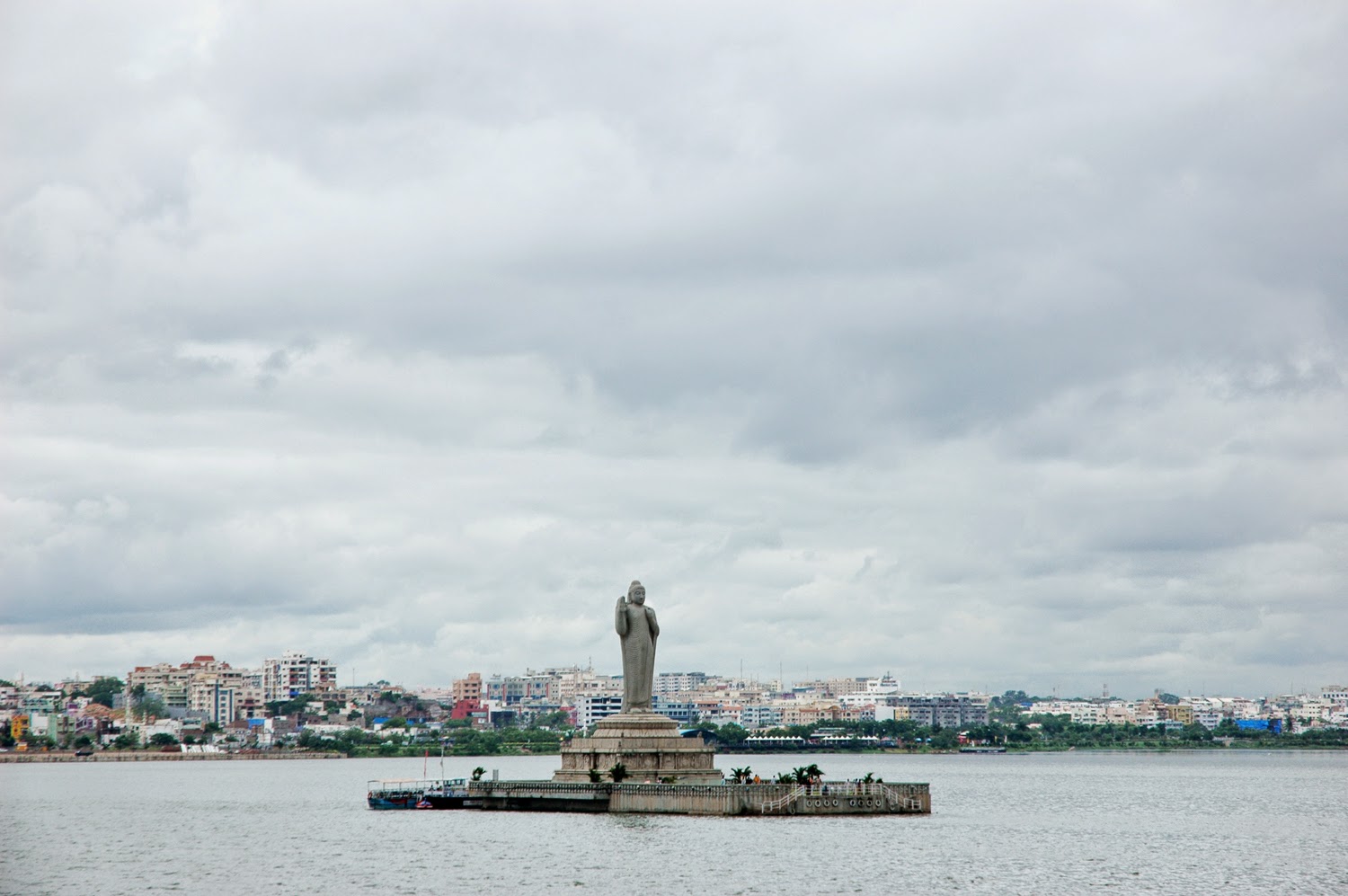
  • Hussain Sagar -  It is a lake in Hyderabad, built by Hazrat Hussain Shah Wali in 1562, during the rule of Ibrahim Quli Qutb Shah. It is fed by River Musi. A large monolithic statue of the Gautama Buddha, erected in 1992 stands in an island in the middle of the lake. Maximum depth of the lake is 32 feet.


  • Saroornagar Lake - It is a lake in Hyderabad. From the year of its creation in 1626, the lake remained largely clean until 1956 when Hyderabad expanded. Spread over 99 acres , the lake was restored by the Hyderabad Urban Development Authority in 2003–04 at a cost of INR 200 million . After the restoration of the lake, migratory birds returned to the lake in big numbers a few years later.


  • Alwal Lake - It is an artificial lake near Hyderabad, about 8 kilometers north of Secunderabad. It is situated in Alwal. There were many issues associated with the lake, which made a highly tensed situation for the Alwal Municipality Officials.


  • Musi River- Musi river also known as Muchukunda River originates in Anantagiri Hills 90 kilometers to the west of Hyderabad and flowed due east for almost all of its course. It joins the Krishna River at Pangal in Nalgonda district after covering a total distance of about 240 km.


Other Lakes -

  • Osman Sagar
  • Himayat Sagar
  • Shamirpet Lake
  • Mir Alm Tank
  • Safilguda Lake
  • Durgam Cheruvu (Secret Lake)
  • Bon Cheruvu
  • Kapra Cheruvu
  • Nacharam Cheruvu
  • Langarhouz Cheruvu
  • Ramanthapur Cheruvu
  • Aryana cheruvu


Birds:


  •  Grebes
  •  Tropicbirds
  •  Pelicans
  •  Cormorants
  •  Darters
  •  Frigatebirds
  •  Bitterns, herons and egrets
  •  Storks
  •  Ibises and spoonbills
  •  Flamingos
  •  Ducks, geese and swans
  •  Osprey
  •  Hawks, kites and eagles
  •  Falcons
  •  Pheasants and partridges
  •  Cranes
  •  Rails, crakes, gallinules and coots
  •  Finfoot
  •  Bustards
  •  Jacanas
  •  Painted snipe
  •  Crab plover
  •  Oystercatchers
  •  Avocets and stilts
  •  Thick-knees
  •  Pratincoles and coursers
  •  Plovers and lapwings
  •  Sandpipers and allies


Thursday, 23 October 2014

Coimbatore - Tamil Nadu

Coimbatore

It is the second largest city and urban agglomeration in the Indian state of Tamil Nadu. It is one of the fastest growing tier-II cities in India and a major textile, industrial, commercial, educational, information technology, healthcare and manufacturing hub of Tamil Nadu. It is referred to as the Manchester of South India.

Hills 


  • Valparai - It is a Taluk and hill station in Coimbatore district of Tamil Nadu. It is located 3,500 feet above sea level on the Anaimalai Hills range of the Western Ghats, at a distance of 100 km from Coimbatore. While major portions of the land is owned by private tea companies, large forest areas continue to be out of bounds. The Government of Tamil Nadu in collaboration with ITDC initiated Tourism promotion through infrastructure development including resorts, hotels and amusement parks to attract tourists.
  • Mettupalayam - It is a taluk of Coimbatore Rural district, located to the north of the city of Coimbatore on the way to Ooty. It is located in the foot hills of Nilgiri hills about 38 km north of downtown Coimbatore. Mettupalayam is the third largest township in the district and one of the fast developing suburbs on the northern side of Coimbatore. 
  • Kovaipudur - It is a large township at the foot hills of the Western Ghats, located in the City of Coimbatore,  It is sometimes known as Little Ooty due to its cool climate and serene environment, and was set up sometime in late seventies. Many small colonies have also come up around Kovaipudur in recent times. Kovaipudur has come under the Corporation of Coimbatore.

Lakes

  • Valankulam Lake- It is one of the lakes in Coimbatore, situated in the Trichy road near Sungam junction. There is a bypass road that connects Trichy road in Sungam junction with Ukkadam. A railway track connecting Coimbatore Junction and Podanur passes though this lake.
  • Ukkadam Lake - Also known as Coimbatore Big Lake, it is situated near to Ukkadam bus-stand. This tank is located north of the River Noyyal.The lake is being fed by Coimbatore anicut channel from the Coimbatore anicut on Noyyal River. The lake also receives surplus water from the Selvachinthamani lake located in the upstream (north-west).The lake is provided with the outlet connection to feed the Valankulam lake, which is located east side of the lake.
  • Perur Lake - 
    The Perur lake in Coimbatore site is an important bird rooting site. Found good number of Pelicans, Painted stork, Open-bill stork, Pond herons, Egrets, White-breasted waterhens, Purple Moorehens, Darters, Cormorants, Kingfishers, grebes, Spot-billed ducks and coots. 
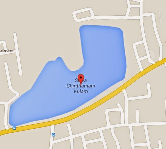
  • Selvachinthamani Kulam- It is located in the city of Coimbatore on north side of Perur road and east Selvapuram. It receives surplus water from the Kumaraswamy Lake. It is a small lake when compared to other lakes located in the city.
  • Singanallur lake - It is a lake in Singanallur, Coimbatore. This in addition to the Valankulam Lake are the ones located in the heart of the city. A railway track connecting Podanur and Irugur passes through this lake. Over 110 species of birds have been spotted in this lake.

Other lakes: 

  • Pudukulam Lake
  • Kolarampathi Lake
  • Narasampathi Lake
  • Krishnampathi Lake
  • Selvampathi Lake
  • Kumarasamy Lake
  • Selvachintamani Lake
  • Sottaiyandi Kuttai Lake
  • Ganganarayanasam Udharam Lake
  • Perur Big Lake
  • Kunniamuthur Sengulam Lake
  • Kunniamuthur Small Lake
  • Coimbatore Big Lake
  • Valankulam Lake
  • Kurichi Lake
  • Vellalore Lake
  • Singanallur Lake
  • Odderpalayam Lake
  • Kannampalayam Lake
  • Irugur Lake
  • Neelambur Lake
  • Sulur Big Lake
  • Sulur Small Lake

Birds :

  • Cormorants
  • Herons and egrets
  • Storks
  • Ibis and spoonbill
  • Ducks
  • Francolin and fowl
  • Crakes and rail
  • Jacanas
  • Plovers and lapwings
  • Godwit, sandpipers and stilt
  • Cuckoos
  • Owls
  • Swifts
  • Kingfishers
  • Bee-eaters
  • Rollers and hoopoe
  • Barbet
  • TernsDoves and pigeons Parakeet

Snakes: 

  • King Cobra (Ophiophagus hannah)
  • Common Cobra (Naja naja) 
  • other colourful snakes

Animals:

  • Asian Elephant 
  • Panther
  • Gaur 
  • Sloth Bear
  • Sambar Deer 
  • Spotted Deer
  • Barking Deer 
  • Mouse Deer 
  • Wild Boar 
  • Nilgiri Tahr or Ibex 
  • Bonnet Mecaque
  • Common Langur 
  • Indian Porcupine 
  • Black-naped Hare 
  • Malabar Giant Squirrel 
  • Wild dog or Dhole 

Chennai - Tamil Nadu

Chennai

Chennai is the capital city of Tamil Nadu. It is a major cultural, economic and educational centre. It is known as the "Detroit" of India for its automobile industry. Chennai is the only city in South Asia and India to figure in the "52 places to go around the world" by The New York Times. Leading tourism guide publisher Lonely Planet has named Chennai as one of the top ten cities in the world to visit in 2015.

Hill Ranges:


  • St. Thomas Mount  - It is a small hillock located in Chennai, near the neighbourhood of Guindy and very close to Chennai International Airport. From the 17th century, this part of Chennai was populated predominantly by Anglo-Indians.The neighbourhood is served by the St.Thomas mount railway station on the southern line of the Chennai Suburban Railway Network Integration of the Metro and MRTS  with the suburban station in the neighbourhood, is expected to make the suburb the city's largest transit hub after Chennai Central. 
  • Tirusulam Hill -This is the tallest hill in the city, and it is special in spiritual things. There is Mosque in the top of the Mountain, and Right side of the hill Tamil Hindu God 'Murugan Temple' is there, and left side of the hill Church is there. The Hill is a shooting spot for Tamil Movies and Television dramas. Some of the movies that have been filmed here include Bhairavi, Oor Kaavalan and Indru Poi Naalai Vaa, Gentleman, Theeradha Vilayattu pillai etc. The central government has also set up a research centre on the hill.
  • Pallavaram Hill - The Pallavaram hill is actually located in Tirusulam and it is quite close to tirusulam railway station (opposite to the airport). The hill served as stone quarry in the past but the quarrying works have been stopped since the airport was built. But the Hill is named after Pallavaram since Tirusulam was less known to people in those days. The Hill is mainly used as shooting spot for Tamil Movies and Television dramas. Some of the movies that have been filmed here include Bhairavi, Oor Kaavalan and Indru Poi Naalai Vaa, Gentleman, Theeradha Vilayattu pillai etc. The central government has also set up a research centre on the hill.
  • Vandalur hill - Vandalur hill is part of Arignar Anna Zoological Park and public entry to the hill is restricted. The hilltop provides a beautiful view of Bay of Bengal. Tamil Nadu Forest department has a sapling center under the foothill of Vandalur hill.
Other Hills - 
  • Perumbakkam Chithalapakkam Hill
  • Tambaram( Naduveerapattu) Hill  

Lakes:

  • Tirusulam Lakes - As Tirusulam has number of mountains, there are small lakes with large amount of water. Because of the presence of these lakes tirusulam census town has never experienced scarcity of water. Due to the presence of the lakes and mountains the living in here is very healthy and very natural.

  • Pallavaram periya eri - Once a sprawling water body covering about 189 acres, has shrunk to a small patch on the lines of a pond on one side and a hillock of garbage on the other. The dumping of garbage from all the 42 wards of the Pallavaram Municipality for nearly a decade is the main reason for the shrinkage of the water body. Nearly 25 acres had been lost to encroachments alone. The construction of Pallavaram–Thoraipakkam Road, a project initiated to connect Chennai Airportand Rajiv Gandhi Salai, had split the lake into two halves. The portion of the lake on the southern side of the road has completely been covered by garbage. On the northern side of the road, the discharge of sewage from commercial establishments and homes and also effluents from some of the leather manufacturing units in Nagalakeni has affected the quality of the water.

  • Velachery Lake - Velachery lake, is one of the lakes inside Chennai, in the Indian state of Tamil Nadu, with a good stock of water all through the year. Since Velachery is a low lying area, the monsoon rain water from the neighbouring areas are drained into this lake.  
Chetpet Lake
  • Chetput Lake - It is a lake spread over 15 acres in Chetput, Chennai. It is located to the north of Chetput railway station. It is the only existing lake at the centre of the city. The lake belongs to the Department of Fisheries of the Tamil Nadu government.
Chembarambakkam Lake
      
  • Chembarambakkam lake -  It is a lake located in the Kanchipuram district of Tamil Nadu,  about 40 km from Chennai. It is one of the two rain-fed reservoirs from where water is drawn for supply to Chennai City, the other one being the Puzhal Lake. The Adyar River originates from this lake. A part of water supply of the metropolis of Chennai is drawn from this lake.
  • Retteri lake - is a lake in the 
    Retteri Lake
    Kolathur area of Chennai. The lake is visible from the 100 ft road, Redhills road Junction which the junction also named Retteri Junction. Government is planned to construct a flyover at the junction.
  • Korattur aeri, - It is a lake spread over 990 acres in Korattur, Chennai, India. It is located to the north of the Chennai—Arakkonam railway line. It is one of the largest lakes in the western part of the city.It is one of a chain of three water bodies, including the Ambattur aeri and the Madhavaram aeri, where surplus water from one is transported to another. The water from the lake had been supplied to Chennai residents for a brief period when there was a shortage in the late 1970s. However, over the years, the lake has been contaminated with sewage and industrial effluents from surrounding areas such as Pattaravakkam, Athipet and Ambattur.
Ambattur aeri
      
  • Ambattur aeri - It is a rain-fed reservoir which reaches top levels during the monsoon seasons. In November 2008, incessant monsoon rain filled the lake and encroachments on the north and south banks of the lake were demolished. It also caters to the drinking water needs of the Chennai city after Poondi andChembarambakkam Lake.
  • Mangal aeri - or Mangal lake, is a rain-fed reservoir in the neighbourhood of Mugappair in Chennai.
  • Manali aeri -  It is a 150-acre lake in the Manali-Mathur-Madavaram area of Chennai. Due to indiscriminate dumping of garbage and sewage, the lake has shrunk to less than 100 acres.

Rivers:

  • Cooum River - The Cooum River originates in a village of the same name in Tiruvallur district, about 70 km (43 mi) away from Chennai, although starting its main course at Sattarai village, around 65 km from Chennai. Close to Egmore, the river forks into two—the northern and the southern arms—both of which join again near the Napier bridge, thus forming an island, known as the Island Grounds. The river finally joins the Bay of Bengal south of the Fort St George, just below the Napier Bridge.It is the most polluted river of India which ends in the city of Chennai draining into the Bay of Bengal. Along with the Adyar River running parallel to the south, the river trifurcates the city and separates Northern Chennai from Central Chennai. Most of the waste from the city is drained into this river and the Cooum.
  • Adyar River- originating near the Chembarambakkam Lake in Chengalpattu district, is one of the two rivers which winds through Chennai, and joins the Bay of Bengal at the Adyar Estuary. The 42.5 km-long river contributes to the estuarine ecosystem of Chennai. Despite the high pollution levels, boating and fishing take place in this river. The river collects surplus water from about 200 tanks and lakes, small streams and the rainwater drains in the city, with a combined catchment area of 331 sq miles.

  • Kosasthalaiyar River - It is one of the three rivers that flow in the Chennai metropolitan area. The 136 km-long river originates near Kaveripakkam in Vellore District and drains into the Bay of Bengal The excess discharge in the river is controlled by the Tamarapakkam Anicut located across the river in the downstream of Poondi reservoir. Vallur Anicut is a small check dam constructed near Minjur across the river to control water levels and feed irrigation channels in the area. It flows to a distance of 16 km in the Chennai metropolitan area. Every year, whenever the floodgates of Poondi reservoir are opened, a considerable volume of water gets drained into the sea through the Kosasthalaiyar river near the Ennore creek.

Wetlands:

  • Pallikaranai wetland - It is a freshwater swamp in the city of Chennai, India. It is situated adjacent to the Bay of Bengal, about 20 kilometres south of the city centre. Pallikaranai marshland is the only surviving wetland ecosystem of the city and is among the few and last remaining natural wetlands of South India. It is one of the 94 identified wetlands under National Wetland Conservation and Management Programme (NWCMP) operationalised by the Government of India in 1985–86 and one of the three in the state of Tamil Nadu, the other two being Point Calimere and Kazhuveli. It is also one of the prioritised wetlands of Tamil Nadu. The topography of the swamp is such that it always retains some storage, thus forming an aquatic ecosystem. A project on 'Inland Wetlands of India' commissioned by the Ministry of Environment and Forests, Government of India had prioritised Pallikaranai marsh as one of the most significant wetlands of the country. The marsh contains several rare or endangered and threatened species and acts as a forage and breeding ground for thousands of migratory birds from various places within and outside the country. The number of bird species sighted in the wetland is significantly higher than the number at Vedanthangal birds sanctuary. 
  • Buckingham Canal -  It is a 421.55 kilometres long fresh water navigation canal, running parallel to the Coromandel Coast of South India from Kakinada in East Godavari district in Andhra Pradesh to Villupuram District in Tamil Nadu. The canal connects most of the natural backwaters along the coast to the port of Chennai . It was constructed during the British Rule, and was an important waterway during the late nineteenth and the twentieth century.It was first known simply as the North River by the British and was believed to be partly responsible for reducing tsunami and cyclone damage to much of the Chennai-southern Andhra coastline

Birds: 

  • Grebes
  • Cormorants
  • Darters
  • Bitterns
  •  herons and egrets
  • Storks
  • Ibises and spoonbills
  • Flamingos
  • Ducks
  • Hawks
  • kites and eagles
  • Falcons
  • Pheasants and partridges
  • Rails crakes and coots
  • Jacanas
  • Plovers and lapwings
  • Sandpipers and allies
  • Snipes and curlew 
  • Gulls
  • Terns
  • Sandgrouses
  • Doves and pigeons
  • Parrots and parakeets
  • Cuckoos
  • Barn owls
  • Typical owls
  • Nightjars
  • Swifts
  • Kingfishers
  • Bee-eaters
  • Rollers and hoopoe 
  • Barbets
  • Woodpeckers